
Bethlehem ZIP Code Directory Coverage
Bethlehem has overlapping postal and municipal maps. The authoritative USPS label list groups Bethlehem postal labels across 18015 through 18018, 18017, and 18020. The research uses verified place anchors rather than claiming a complete municipal boundary for any code. Confirm an individual delivery address with USPS before choosing a property, tax, Recorder, school-tax, or court route.
| ZIP Code | Areas Covered | Post Office | Notes |
|---|---|---|---|
| 18015 | South Bethlehem anchor at BAPL South Side, 400 Webster Street | USPS verification required | South Bethlehem is in Northampton County under the City neighborhood map |
| 18016 | Bethlehem postal-facility anchor | Bethlehem Post Office, 535 Wood Street | The facility uses 18016-9998; it is not a one-to-one neighborhood map |
| 18017 | Northern and industrial postal-area anchor | Lehigh Valley Postal Store, 17 S. Commerce Way | May include nearby non-City areas; check the exact parcel |
| 18018 | Historic downtown and north-side anchor at City Hall | USPS verification required | City Hall shows the code occurs in the City, not its full boundary |
| 18020 | BAPL Coolidge and Bethlehem Township postal-area anchor | USPS verification required | A Bethlehem label can be outside the City of Bethlehem |
Census ZCTAs are statistical approximations, not USPS delivery boundaries. A code can be useful for checking a mailing label, yet still be the wrong tool for locating a particular parcel or deciding its county. That difference is the core rule for every Bethlehem ZIP code directory search.
Bethlehem ZIP Code Postal Anchors
The 18016 result is a useful facility clue, not a neighborhood assignment. The official Bethlehem Post Office at 535 Wood Street uses 18016-9998. The manifest image comes from the USPS Bethlehem Post Office listing, which identifies the postal facility used as a delivery and post-office reference.
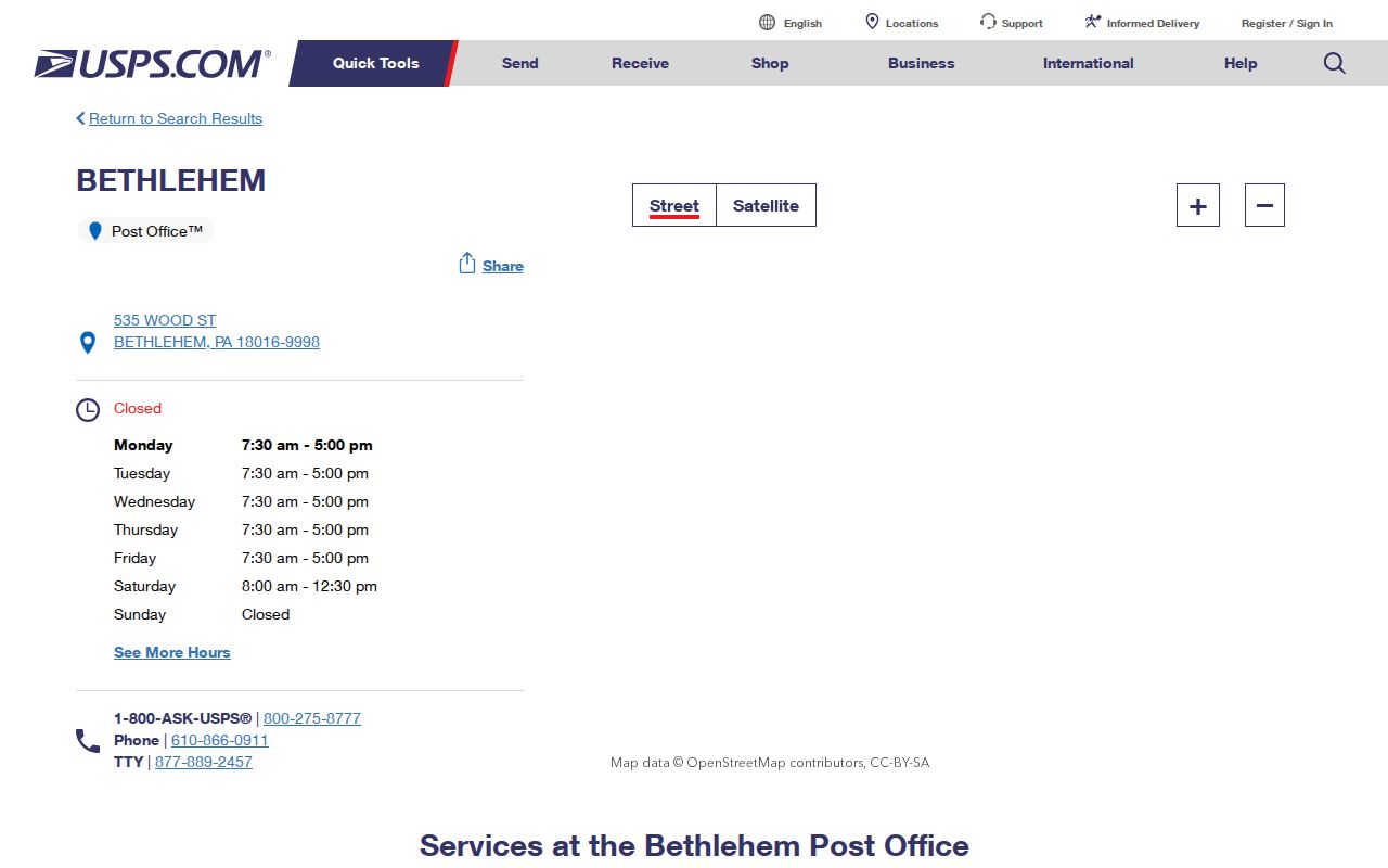
The facility image helps distinguish a post-office address from a citywide ZIP boundary. It does not show which people live in a code, establish a legal parcel, or determine whether a particular Bethlehem mailing address falls in Lehigh or Northampton County.
Bethlehem ZIP Code County Split
Roughly two-thirds of Bethlehem lies in Northampton County and about one-third in Lehigh County. West Bethlehem is entirely Lehigh in the City's census-neighborhood framework, while South Bethlehem is entirely Northampton. Central and Northeast Bethlehem need a parcel-level review. A ZIP does not choose between the county assessment systems, deed offices, probate lanes, or elections offices.
After a USPS result, open the municipality and parcel fields in county GIS. The Lehigh Parcel Viewer has address, PIN, and assessment-address routes. The Northampton Tax Parcel Viewer has property location, map-block-lot, owner, universal-search, and map-browse modes. The county field, not the ZIP, selects the rest of a property-record trail.
Note: A Bethlehem postal label may cross municipal context, but a parcel's county remains the practical starting point for local land records.
Verify a Bethlehem ZIP Code
The official USPS ZIP Lookup is the first delivery-label check. It offers Find by Address and Find by City and State. The result is useful for standardizing an address, but it does not confirm that a named person or organization is connected to that address. It also does not settle municipal limits, parcel identity, or county responsibility.
- Enter the actual street address in the USPS address route, including the unit when it is part of the delivery address.
- Record the returned delivery label and ZIP, then compare the location with the county GIS municipality and parcel field.
- Use the parcel, UPI, PIN, CAMA, or deed reference to reach assessment and Recorder records in the correct county.
- For historic address work, retain the street number and legal description before comparing a directory, census, map, or deed.
- When the ZIP has narrowed an area to a street, use the Bethlehem street directory for the address-keyed parcel and deed workflow.
Local portals did not provide a verified ZIP-wide people-search control in the source review. Northampton's address layer has a ZIP Code attribute, but the public Tax Parcel Viewer exposes location, parcel, owner, and map modes rather than a confirmed ZIP resident roster. Use the verified controls, not a feature that has not been documented.
Pennsylvania's formal voter products do not fill that gap with a ZIP browse screen. The Public Information List, Street List, Walking List, and Full Voter Export are county products that require the state request form and its affirmation. The Street List is $20 per county and contains name, residence and mailing address, party, and active or inactive status; the Walking List excludes the mailing address. A ZIP can help narrow a mailing question, but the request path stays county-based and restricted.
USPS ZIP Code Search Fields
The USPS form has two distinct functions. Address mode checks a specific delivery location. City-and-state mode can return associated City and State results for a ZIP. Neither mode is a person lookup, and a standardized USPS label must still be compared with county GIS for a Bethlehem records search.
| USPS field | Type | Required use | What it returns |
|---|---|---|---|
| Company | Text | Optional in address mode | Delivery-line detail, not confirmation of a company connection |
| Street Address | Text | Required in address mode | Delivery-label candidate for the entered address |
| Apt/Suite/Other | Text | Optional | Secondary-address detail |
| City and State | Text and dropdown | Required for city/state mode | Postal-city search input, not a county decision |
| ZIP Code | Text | Required in ZIP-to-city mode | Associated City and State results |
A returned ZIP is only step one. The next two steps are county GIS and the county assessment or Recorder channel. That sequence keeps a ZIP code directory search tied to a physical parcel instead of treating a broad postal geography as a resident roll.
Bethlehem ZIP Code Record Trail
Once a Bethlehem address is verified and mapped, property records can supply a parcel, physical location, owner field, mailing line, sale or deed reference, and record-specific details. The parcel link then leads to the County Recorder. A deed can show recorded parties, date, legal description, and a predecessor book-page or document reference. It does not establish all current occupants.
For a Lehigh parcel, use the property record before the Landex route. Lehigh's public search has a Search Text field with Address, Parcel Identification, and Document ID or Instrument Number options, plus a captcha. For a Northampton parcel, the tax viewer's House Number and Full Road Name route exposes the CAMA and deed bridge. When online records are incomplete, the Recorder counter, terminal, or originating-office microfilm is the documented fallback.
City permit and historic-review records are another location-specific channel. Their reports and files may corroborate work at a property, but they are not a ZIP-wide directory. A specific City record that is not published can be sought through the City RTKL form rather than a broad request for a list of people.
Bethlehem ZIP Code Map Limits
ZIP boundaries and City limits do not match. The 18020 Bethlehem Township anchor is the clearest local reminder: a Bethlehem postal label is not proof that an address is inside the City. The 18018 City Hall anchor proves the code occurs in the City but does not chart its complete boundary. Postal geography must be checked address by address.
- ZIP versus ZIP+4
- A ZIP identifies a postal delivery area; ZIP+4 adds a narrower delivery segment or address grouping.
- PO-box ZIP
- A postal code associated with a post-office or box-delivery context, not a mapped residential neighborhood.
- Unique ZIP
- A code assigned to a single organization or facility; no such Bethlehem assignment is claimed here without USPS confirmation.
- Carrier route
- A delivery route grouping used by postal operations, not a municipal boundary or resident roster.
The City also keeps a separate historic-district and neighborhood context through its maps and review records. Those civic boundaries can be helpful for place history, but they do not replace a USPS label or a county parcel map.
Bethlehem ZIP Code Change Trap
The postal map is only one part of an older address problem. Five municipalities merged into the City during the 1917 to 1918 transition, and many South Bethlehem street names changed. Lehigh University's Beyond Steel project maps a 1900 address even when a later map uses a different street name. It also combines the 1900 to 1901 Sholes' Directory, Sanborn maps, and selected census material.
Keep the historic municipality, printed street name, old number, and legal or parcel identifier when comparing records. BAPL guidance notes an address example that appears as 24, then 121, then 421 over different decades. A modern ZIP can assist with a present delivery label, but it cannot translate a historic address by itself.
Sanborn maps offer a second check for an address that seems to vanish. BAPL has 1885, 1892, 1897, 1904, and 1912 map material, with a modified 1912 edition, and the Library of Congress offers the 1892 Bethlehem sequence online. A map can show the building outline, street or house-number pattern, and boundaries in its edition. It cannot supply a continuous list of people who lived there.
Bethlehem ZIP Code Directory Limits
A Bethlehem ZIP code directory can organize postal and parcel research. It cannot identify every person who receives mail in an area. County GIS and assessment systems show parcels and owner-related fields, not every household member. The Pennsylvania voter-status page is an individual-status route, while the authorized voter-list products are county products with requester affirmations and restrictions on online publication.
Northampton's election office warns that court-approved redistricting implementation affects the 2026 primary, so a polling location or district tied to an older address should be rechecked with the official locator. Public records may also show substitute or limited information for Address Confidentiality Program participants. Do not try to infer or uncover a protected address.
Lawful use. Use Bethlehem postal and parcel information for lawful personal, family-history, property-curiosity, civic, or anti-scam purposes. Never use a ZIP, address, map, or record to stalk, harass, intimidate, or harm another person.