
Trace a Bethlehem Street Directory
Bethlehem crosses the Lehigh and Northampton county line, so a postal city line cannot select the right assessment office or Recorder. Begin with the actual address in the county property system. The returned parcel, UPI, CAMA, map-block-lot, or deed-reference field is the bridge to a recorded land document. Read the physical location and an owner mailing line as distinct labeled facts. Property systems show public parcel and owner information, not a complete household roll.
- Confirm the delivery address, then open the county parcel or assessment channel for the lot.
- Write down the parcel identifier, physical location, owner line, and deed reference exactly as displayed.
- Use the document number, book and page, or named party in the Recorder or Landex channel.
- Follow the predecessor reference in the deed and compare the legal description when a street label changes.
- After the parcel trail is secure, use a dated Bethlehem Room directory or census source for an occupant clue.
The formal voter Street List and Walking List are separate county products, not a public browse tool. Pennsylvania requires a request form, requester details, and a legal affirmation. The Street List includes name, residence and mailing address, party, and active or inactive status. The Walking List omits the mailing-address column. A request that legitimately spans the City needs Lehigh and Northampton material separately.
Note: A property owner, an old directory entry, and a current occupant are different claims that need different dates and records.
Bethlehem Street County Split
About two-thirds of the City lies in Northampton County and about one-third in Lehigh County. The City census-neighborhood framework places West Bethlehem in Lehigh and South Bethlehem in Northampton, while Central and Northeast locations need a parcel-level check. A Bethlehem mailing label does not decide the county for assessment, deeds, estates, elections, or court work.
Use the official USPS ZIP Lookup to check a delivery label, then compare the address with county GIS municipality and parcel fields. The Lehigh public property search accepts an address, PIN, or document/instrument number. The Northampton Tax Parcel Viewer has location, parcel, owner, and map routes. Neither system makes the postal label a county decision.
Northampton Street Address Search
The Northampton Tax Parcel Viewer is the most detailed current address route captured for the Bethlehem street directory. Its property-location path starts with House Number and then a dependent Full Road Name. Use conventional suffixes such as RD, ST, or AVE. A map result can show the CAMA and deed bridge. Map browsing or an extent selection can then inspect individual parcels along a visible segment.
| Viewer field | Type | How it works | Street use |
|---|---|---|---|
| House Number | Text | First part of the property-location query | Starts an address search |
| Full Road Name | Text | Depends on the house number and uses a suffix | Completes the location query |
| Map, Block, Lot | Text chain | Map first, then block and lot | Uses a legal parcel key |
| Owner Line 1 contains | Text | Optional last-name fragment query | Checks an owner line, not an occupant |
| Select | Map extent | Inspects mapped features without public export | Browses parcels on a segment |
The viewer also offers Universal Search, measurement, printing, and map browsing. Its public Select configuration does not export results. The official address layer carries ZIP, municipality, unit, road, and UPI attributes, but those geographic fields do not create a roster of people at an address.
Bethlehem Street Ownership Labels
Read each field by its label. The situs address is the physical parcel location. An owner mailing address is a correspondence field and may be elsewhere. A parcel is the county's identified piece of land. A UPI, CAMA identifier, or map-block-lot reference ties that land to assessment and mapping systems. A plat is a mapped lot or subdivision reference used with that land identity.
- Parcel
- An identified tract or lot that connects assessment, map, and deed records.
- Situs address
- The physical street location of the parcel, distinct from an owner mailing line.
- Plat
- A mapped land reference that identifies lots, blocks, or subdivision context.
- Criss-cross directory
- A directory arranged by address, used to locate a listed household or business in a dated edition.
Northampton requires UPI certification for a conveyance, and Lehigh requires a UPI or PIN on relevant recording documents. Those identifiers help when a literal address search fails. The City directs physical or mailing-address changes to the county of the parcel, which later moves information to City and school tax offices. That administrative route is another reason not to equate a mailing field with residence.
Lehigh Street Deed Trail
For a Lehigh-side address, the parcel record supplies the starting PIN or document reference. The Landex Webstore provides County and Document Type controls, person-name fields, date limits, Instrument Number, and Book and Page paths. A broad request may be rejected, and visible results are capped at 200. The Bethlehem Area Public Library house-research guide separates later document-ID work from older book-and-page research.
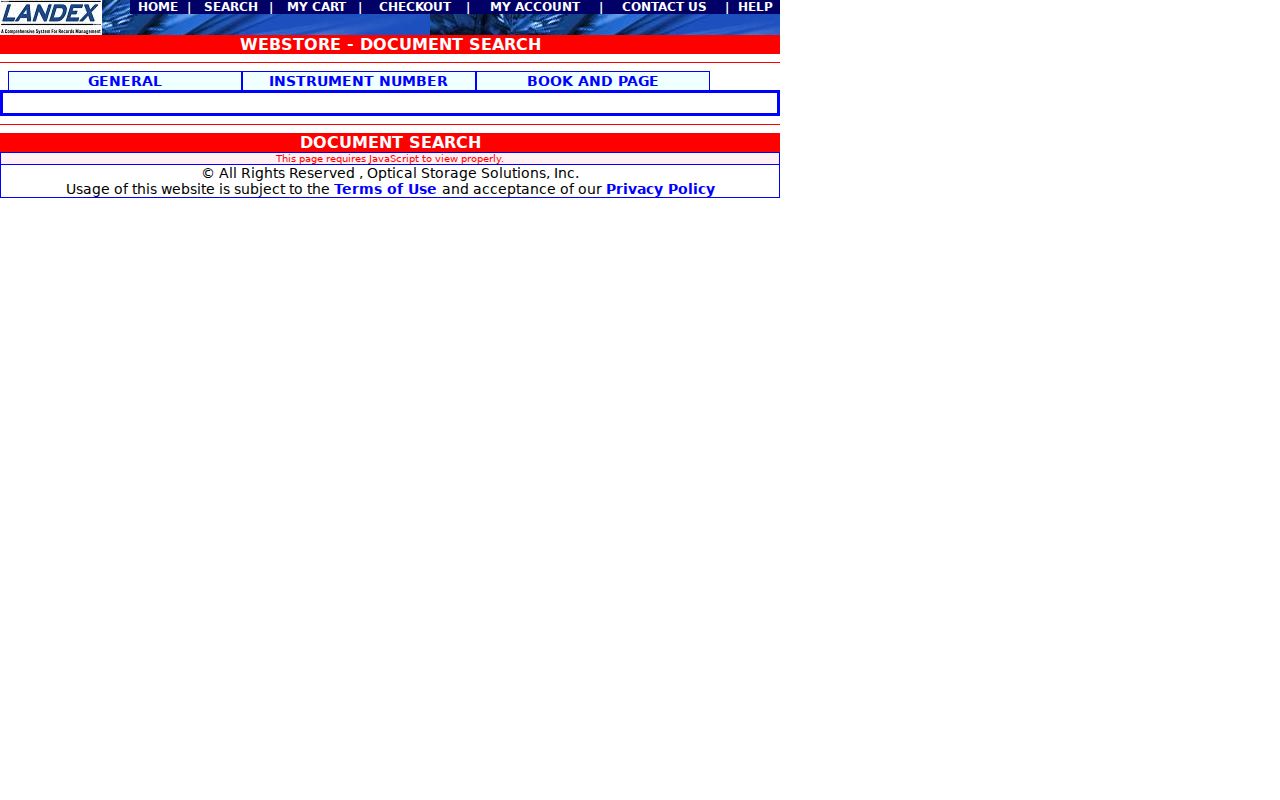
The Landex document-search screen is the researched route for a Lehigh deed reference. Its General, Instrument Number, and Book and Page tabs support the change from a current address to the recorded document.
When a predecessor deed gives a book and page rather than an instrument number, keep that citation. The BAPL guide directs researchers to Landex for post-1984 document identifiers and to the Russell Index book-and-page route for older Lehigh work. The format switch is not an earliest-record date: Lehigh Recorder holdings reach 1812. Confirm live charges before ordering an image or copy.
Note: Recorder staff can help with a specific identifier, but the county says staff do not conduct a title search or give legal advice.
Bethlehem Street Records
A street directory works best when each source remains in its own lane. County maps establish location and parcel identity. Recorder records document a recorded transfer. City permit and historic-review files can date proposed or approved work. Historical directories and Sanborn maps add a time-specific address layer. The table keeps the access channels and limits visible.
| Address record | Custodian | What it can establish | Access route |
|---|---|---|---|
| Assessment and parcel record | Lehigh or Northampton county | Parcel, situs, owner field, mailing line, and deed reference | County property system and GIS |
| Parcel map | County GIS | Parcel geometry, address, municipality, and map identifiers | Map browse and parcel inspection |
| Recorded deed | County Recorder | Recorded parties, date, legal description, and predecessor reference | Landex, Recorder terminal, counter, or microfilm |
| Permit or historic review | Bethlehem Code Enforcement or review boards | Public project and review history for a location | Published reports, office, or RTKL request |
| Historic directory or map | BAPL and related collections | Dated address listing or built-form context | Bethlehem Room, local collection, or microfilm |
On the Northampton side, the Recorder gives an instrument a volume and page, images it for retrieval stations, and keeps public inspection channels. When a computer sequence no longer resolves an older reference, the Recorder counter's hard-copy and microfilm path matters. The Northampton County Archives says microfilm remains at the office of origin rather than one universal online database.
The two counties have different historical depth and delivery routes. Lehigh Recorder holdings reach 1812, with records kept in books through April 19, 2002 and computer images beginning April 22, 2002. Northampton's State Archives guide lists deeds from 1752 to 1866 and grantor-grantee indexes from 1752 to 1926, but the archive guide does not make those years a promise of current web images. Use the older index or originating office as the cited channel requires.
Bethlehem Street Permit Records
City records are a separate address layer. The Permits Issued collection has static monthly building, mechanical, plumbing, and electrical reports visible from January 2011 through July 2026 during research. A report can include activity or status, date, type, parcel, owner name, description, and site address. It is a project record, not a residence list.
The Bureau of Code Enforcement can provide an application at 610-865-7091. The public counter is temporarily closed Wednesday afternoons from 1:00 to 4:30 while files are digitized. In the historic core, the City's Historic and Conservation Districts route has HARB and HCC applications, agendas, and council material that can help date visible work. A narrow City RTKL request is the fallback for an existing municipal record that is not published.
Bethlehem Street Number Changes
Bethlehem's historic address trail has a local trap. Five municipalities merged into the City in the 1917 to 1918 transition, and many South Bethlehem street names changed. BAPL guidance gives an example of one property appearing as 24, then 121, then 421 over successive decades. Keep the printed municipality, original street name, number, and parcel or legal description with each older citation.
Lehigh University's Beyond Steel project maps a 1900 address even when a later map uses a different street name. Its address results combine the 1900 to 1901 Sholes' Directory, selected 1900 Census data, and Sanborn material. For the longer historical shelf and dated volumes, use the Bethlehem city directory collections rather than treating a current parcel record as a history of every household.
The Bethlehem Area Public Library keeps Greater Bethlehem city directories from 1895 forward in its Bethlehem Room, including named early Sholes volumes and later Directory of the Bethlehems and Polk runs. Its Sanborn map access includes 1885, 1892, 1897, 1904, and 1912 material, with a modified 1912 edition. Match the exact edition to the address date instead of assuming an annual run.
Bethlehem Street List Limits
Pennsylvania's individual registration-status form is not a public street-browsing interface. Its official alternatives are the online status form, the county voter-registration office, or 1-877-VOTESPA. For an authorized request, the state voter-list request form has county, product, requester-identity, signature, and legal-affirmation controls.
The $20-per-county Street List and Walking List are electronic products with restrictions on use and online publication. Requesting a product does not make it a durable residence history. Active or inactive status can change when people move, die, answer notices, or remain inactive under the relevant process. Protected participants may have limited or substitute information.
Note: County election material must remain within the state form's stated conditions and cannot become a general street roster.
Bethlehem Street Directory Limits
Public land and map records can show a parcel, labeled owner or mailing fields, a recorded document trail, and selected project records. They cannot responsibly identify every non-owner occupant, relative, protected voter, utility customer, delivery recipient, school record, DMV address, or temporary visitor. Pennsylvania's Address Confidentiality Program can place substitute addresses in government records, so a blank or unusual entry is not a problem to solve.
Lawful use. Use Bethlehem address records for lawful personal, family-history, property-curiosity, civic, or anti-scam purposes. Pennsylvania law prohibits stalking and harassment, and public information must never be used to stalk, harass, intimidate, or harm another person.
For a suspicious deed notice, compare the document with the correct county Recorder record and seek appropriate legal or law-enforcement help rather than sending money or personal information to an unsolicited contact.